Spatial intelligence that goes beyond navigation. Accurate to the inch. AI-Powered.
ION - Indoor Outdoor Navigation - transforms any environment into a precisely mapped, trackable space. Powered by a proprietary geomagnetic engine and supported by a hardware suite for real-time asset and personnel tracking, ION gives partners the tools to build clear, reliable spatial awareness into their products and workflows.
Tech that does what your everyday navigation software cannot
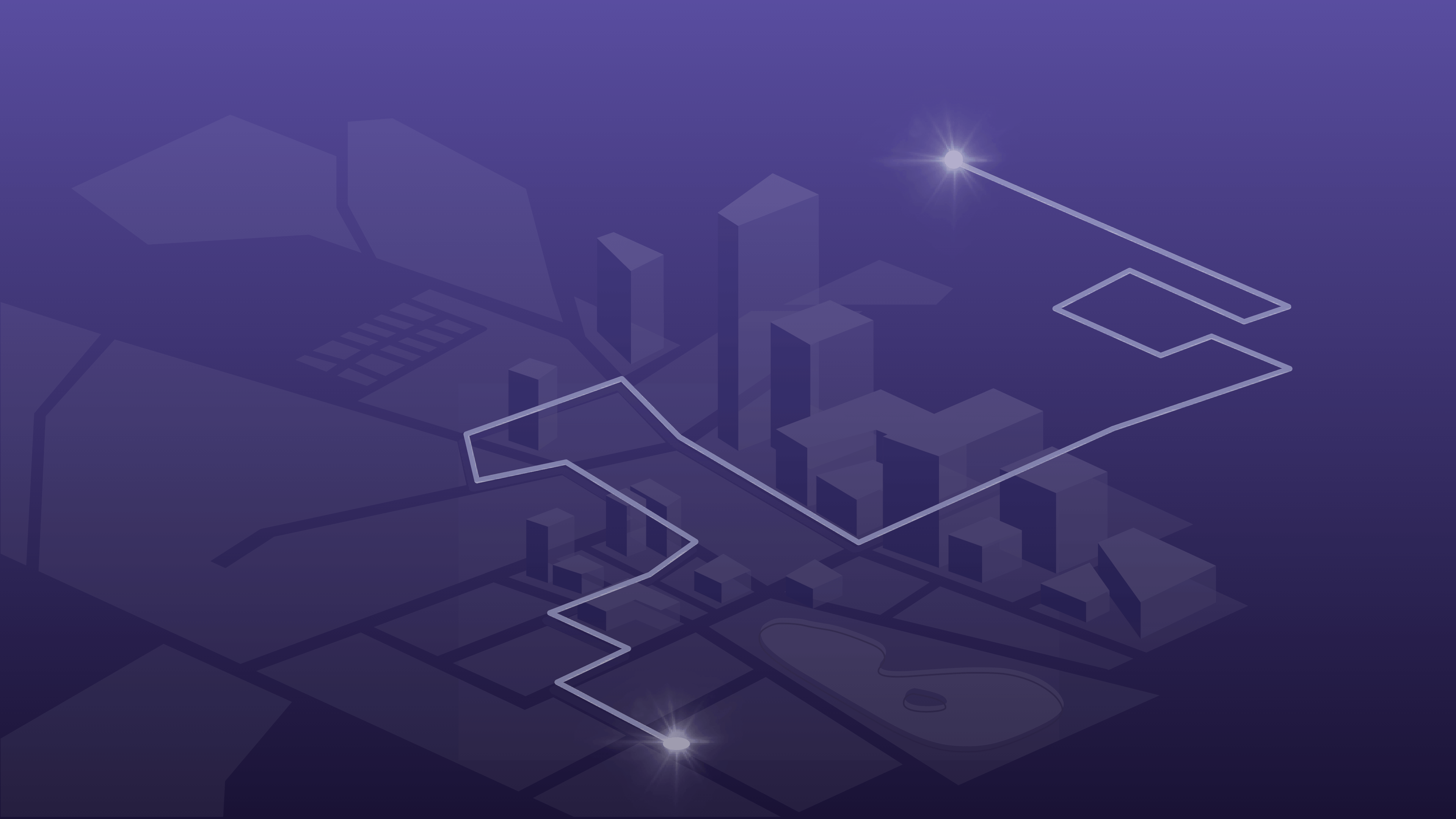
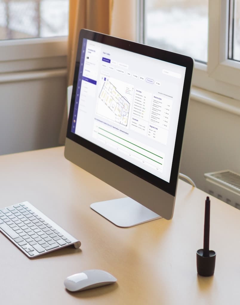
ION uses the natural geomagnetic field of space to deliver accurate blue-dot positioning without relying on external signals. Combined with a suite of tracking devices and advanced mapping tools, organizations gain visibility into the real-time movement of what’s important. All of this across multi-story campuses, underground facilities, and even as people navigate between levels and between indoor and outdoor spaces.

What ION Delivers
Inch-Level Accuracy
Reliable positioning across any type of space - no WiFi or Bluetooth dependency.
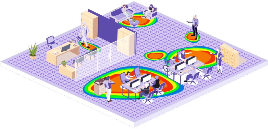
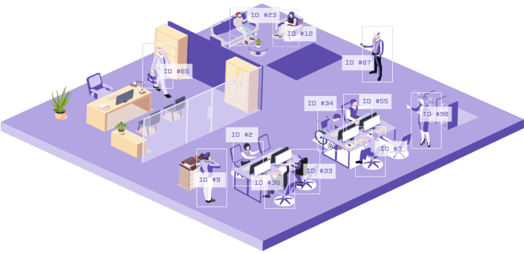
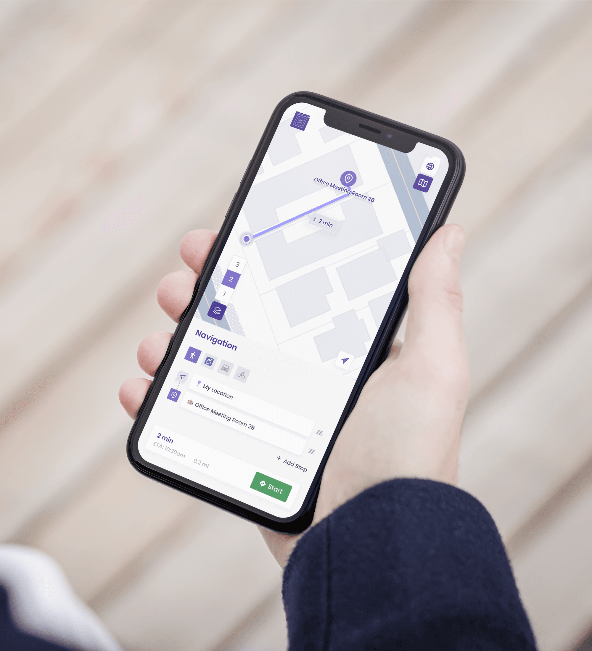
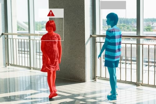
Full asset & personnel tracking
Badges & wristbands offer real-time visibility for security teams and operations.
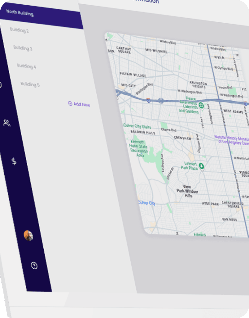
Mapping at scale
Digitize a space through streamlined self-mapping or robot-assisted mapping.
One Unified System
Maps, analytics, and movement data live in a centralized CMS for clarity and faster decision-making.
Flexible Integration for Developer
Badges & wristbands offer real-time visibility for security teams and operations.
Built for Complex Environments
High-density, ever-changing, underground, indoors, outdoors, multi-story - ION adapts with precision.
The ION Platform
ION’s product suite is a complete intelligence system that brings together mapping, tracking, and analytics for a comprehensive view. Each component works independently or as a part of the end-to-end solution. Whatever your use case for your space, ION has a way.

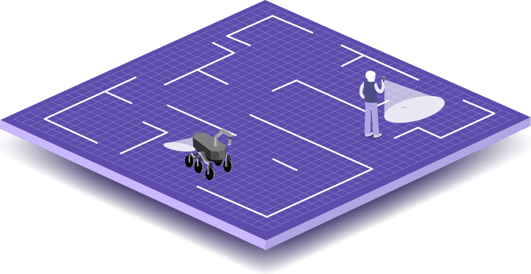
Robotic Mapping Tools
LiDAR enabled autonomous rovers that map the most complex spaces, so you save on manual labor and time.
ION CMS
A centralized system for maps, crowd density analytics like heatmaps, tracking insights, and security + operational awareness

ION SDKs for Developers
Designed for flexibility, letting partners integrate navigation and tracking into their own products.
ION Acquisition App
Purpose-built to streamline mapping, positioning calibration, and environment digitization using ION technology.
Tracking Devices
Badges, wristbands, and tags that ensure safety of critical assets and individuals with use cases across industries like mining, healthcare, etc.
Robotic Mapping Tools
LiDAR enabled autonomous rovers that map the most complex spaces, so you save on manual labor and time.
Blogs
Explore our blogs below.


Mapping Everything, Everywhere
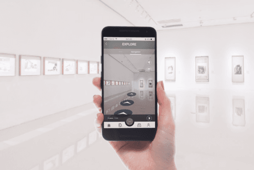
Museums & Exhibitions
Hospitals & Healthcare
Retail & Shopping Malls
Airports & Transportation
Smart Offices
Event Venues
More...
Whether your space spans 1,000 sq ft or 100,000, sits 50 feet underground or rises 500 feet above ground, ION maps it with precision. The system scales to any footprint and adapts to the unique layout and conditions of your environment.